|
|
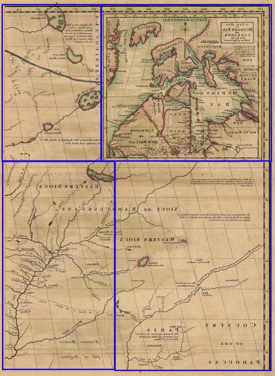
 This upper-left corner of John Mitchell’s map of North America, "A Map of the British and French Dominions in North America...," shows the limit of English interest as of the mid 18th century. Both England and France hoped to find a water route through the continent—a “Northwest Passage.” The inset of Hudson’s Bay includes the cartographer’s speculations on its probability. The Indian nations identified here, although known to both the French and English, were not in close contact with Europeans other than to trade, and their warriors played little part in the war. |
|
|
 |
|
[Map showing land of the Sioux and Padoucas.] One plate from “A Map of the British and French Dominions in North America with the Roads, Distances, Limits, and Extent of the Settlements Humbly Inscribed to the Right Honourable The Earl of Halifax and the Other Right Honourable The Lords Commissioners For Trade and Plantations by their Lordships Most Obliged and very Humble Servant Jn. Mitchell.” Title of inset map: Engraving by Thomas
Kitchin. |
 Fuyitang-contact@mfbzone.net
生辰八字算命
SJM-(SJM)-customerservice@jyrjfs.com
Spinach-Forum-media@gy1111.net
三优光电
SJM-(SJM)-sales@yyae.net
God-of-the-sea-admin@getrealcuba.com
广东交通在线
赞禾股份
猿题库
上海西郊骨科医院
Sands-Macao-admin@rebook-instock.com
美高梅
Sabah-Sports-app-customerservice@nsibayak.com
美高梅
Top-10-electronic-games-service@eurofans.net
HIGO
沙巴体育
黄鹤楼文学
博普智库
永城人
大王椰板材
同花顺财经新闻频道
吾爱一刻广场舞
在线HTML编辑器
学美网
爱尚女性网
高唐信息港
长沙网
卡盟网
99心理健康频道
北京赢商网
达人贷
QQ千寻社区
绝对100婚恋网
Fuyitang-contact@mfbzone.net
生辰八字算命
SJM-(SJM)-customerservice@jyrjfs.com
Spinach-Forum-media@gy1111.net
三优光电
SJM-(SJM)-sales@yyae.net
God-of-the-sea-admin@getrealcuba.com
广东交通在线
赞禾股份
猿题库
上海西郊骨科医院
Sands-Macao-admin@rebook-instock.com
美高梅
Sabah-Sports-app-customerservice@nsibayak.com
美高梅
Top-10-electronic-games-service@eurofans.net
HIGO
沙巴体育
黄鹤楼文学
博普智库
永城人
大王椰板材
同花顺财经新闻频道
吾爱一刻广场舞
在线HTML编辑器
学美网
爱尚女性网
高唐信息港
长沙网
卡盟网
99心理健康频道
北京赢商网
达人贷
QQ千寻社区
绝对100婚恋网